So, now that I have explained that, it will make sense (hopefully) to you that we filed an IFR flight plan. This meant that we will be talking on all the same frequencies as the airliners and flying on similar routes, but at lower altitudes since our airplane's altitude limitation is 18,000 feet (or in pilot terms, flight level 180, for "flight level one-eight-zero"). The only problem is that if we were to fly all of the exact routes required for our IFR flight plan, it would take us right through some really big clouds on our climb from Provo to FL180. We didn't want to do that mainly because we are not allowed to and also because we would likely accumulate ice if we flew through the clouds, making flight some what dangerous. Our plane does not have protection from ice accumulation like all airliners and sophisticated jet transports, thus we wanted to steer clear. Our solution to this problem was to takeoff from Provo under Visual Flight Rules. For us, this meant we could pick our own route through the clouds, then call Salt Lake Approach Control (the local Air Traffic Control agency) and change over to our IFR flight plan. We would then be required to follow those separate set rules. Confused yet?
So, takeoff VFR we did! We flew out over Utah Lake, found a hole in the clouds, and poked through without ever touching a cloud.
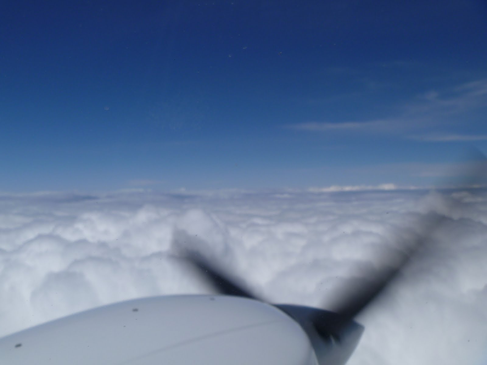 |
| This is what we saw when we got above the clouds. Normally we would be able to see Utah Valley and Salt Lake Valley. |
 |
| Another shot looking off the wing. |
I should mention that that funny looking mustache on Matt is actually an oxygen mask. It has two nose prongs and puts out a steady supply of oxygen to keep us alive in the thin air.
Once we got going, everything was relatively uneventful. We climbed up to our cruising altitude, set cruise power and enjoyed the ride. While in cruise, we monitor the engine instruments, fuel levels and temperatures (it's cold at FL180! -24 degrees celsius on our way to Boise... it would be bad if our fuel froze!) and our flight plan progress. We look at checkpoints in our flight plan and compare the planned data to our actual data. For instance, we look at our calculated ground speed versus our actual groundspeed. You'd be surprised how accurate we can be with just the forecasted winds/temperatures and a pilot's slide rule (E6B). The purpose of checking the accuracy of the flight plan is to make sure we are aware of how much fuel we are really burning. Are we going faster than planned? Well, then we are using less fuel. Slower? Then more fuel is being used. All this is pretty quick to calculate though, so we also socialize quite a bit. Luckily Matt and I get along really well.
As we got closer to Boise's airport (KBOI), ATC started having us descend in preparation for the approach into Boise. We were able to skip around a few clouds, and we were cleared to fly the RNAV(GPS) Y RWY 28R approach (pronounced: Are nav gee pee ess yankee runway two-eight right) and we landed without any even. We got fuel at a jet center, grabbed a quick bite, and used the restroom. we then did a brief pre-flight and taxied FOREVER to the departure runway.
More to come soon on the rest of my trip!
No comments:
Post a Comment